The discipline of biogeography involves studying the distribution of species throughout time and space, and aims to understand the causal environmental and historical factors influencing the observed distribution patterns. Habitats vital for the survival of a species as well as their connectivity can be identified and evaluated.The basis of population research is an understanding of the current size and structure of the population of interest. Scientists strive to know how many individuals there are, and how many of them are adult males and females. With this knowledge, models can be developed and applied to predict how the population will most likely develop in the future and which habitats are crucial to its survival.
Sea Turtle Population Research
To protect sea turtles and their habitats is, above all, the main aim of our sea turtle research. All seven species of marine turtles are threatened by extinction. In order to create effective turtle conservation and management strategies, we, first of all, need realistic estimates of population size and distribution.
The starting point for ecological and conservation studies is often the ability to identify individuals, followed by statistical modelling. A series of photos can, for example, reveal patterns of residency and movement between reefs, determine the population size and structure of a reef at a given time, and calculate inter-nesting periods.
The key questions we aim to answer through our research are:
- What is the size and distribution of the sea turtle population in the Indian Ocean?
- Which habitats are used by sea turtles and how are they connected?
- Which sea turtle habitats need protection?
- How does the sea turtle population change over time?
- What are the population boundaries for different sea turtle populations?
- What are the management units for sea turtles in the region?
- Are sea turtle conservation efforts effective?
How To Count Sea Turtles
There are primarily three methods to identify individual and count how many sea turtles there are :
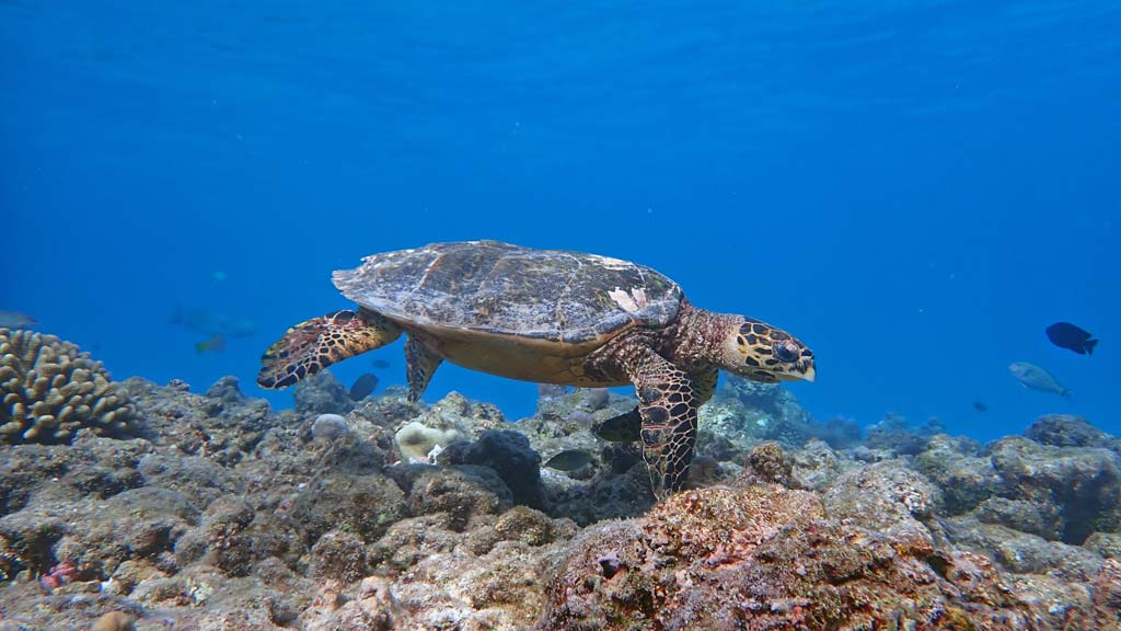
Sea Turtle Photo-ID
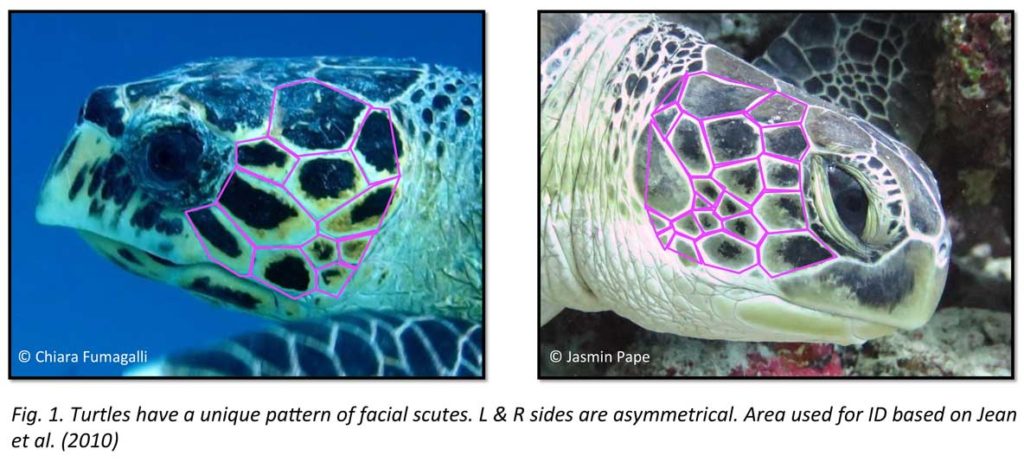
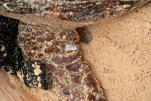
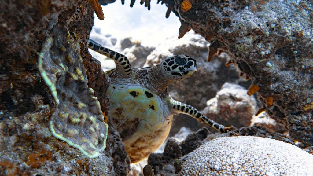
Photographic identification (photo-ID) is an approach that utilises photographs and films of conspicuous features on the animal’s body or footprints to aid in its individual recognition.
Sea turtles can be individually identified based on the arrangement of scutes on the sides of their faces. It works the same way flipper tagging does, by enabling the identification of individual animals.
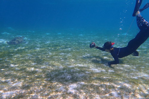
Photo-ID can be used on nesting beaches, but also in in-water studies, and is thus applied broadly to sea turtles of nearly all life stages. It potentially provides insight into the use of neritic coastal areas by sea turtles and may further enhance our understanding on late-stage juveniles and space use throughout their lives. To do so, we use Capture-Mark-Recapture (CMR) methods that have previously been used on other taxa. The natural markings of sea turtles are stable over the long term, allowing us to use non-invasive CMR methods.
flipper Tagging
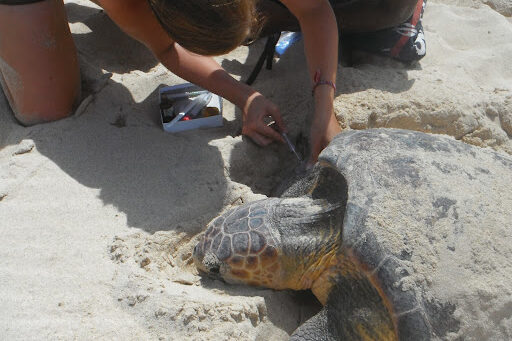
Flipper tagging is a very common research method and often applied in combination with nesting research. Flipper tagging has been the traditional method used to monitor sea turtles’ numbers, movements and behaviour.
To identify individual turtles, each turtle may carry a set of metal or plastic tags, usually placed on the trailing edge of each front flipper, each bearing a specific identification code, and a contact address. When a turtle is observed with a tag, the number is recorded on a database, and if the code is unknown, the information can be sent to the contact address for more details on the turtle’s origin.
Apart from external flipper tags, sometimes internal so-called passive integrated transponder (PIT) tags are used to mark animals. These might be familiar to dog and cat owners, as they are the little microchips used to mark everyday pets as well.
Microchips can be read with a PIT scanner. They are more long-lived than flipper tags, but unfortunately not visible from the outside and therefore can be missed more easily.
The main problems with using flipper tags to track sea turtle movements are that large numbers must be deployed to ensure sufficient recaptures, and biases are present in the likelihood of recapture and reporting. Although animals can be tracked with flipper tags over different time scales, from within a single season to possibly up to decades, little is known of the intervening route and speed.
Tagging is costly and can cause stress to the turtle. Furthermore, tags seldom stay attached for a lifetime and are also difficult to apply, thus limiting the number of deployed tags and the participation of untrained volunteers and citizen scientists, which is why we at ORP are primarily working with the photo-ID method.
Satellite Tagging
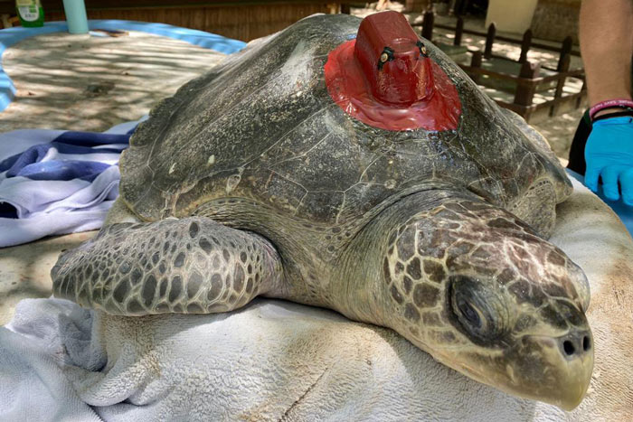
The term satellite tagging refers to the attachment of a satellite transmitter on the body of the animal of interest. Satellite tracking is a convenient way to study sea turtles and their complex life cycles for a number of reasons.
Firstly, given its global coverage, satellite tracking allows us to follow turtles in near real time and find out what routes they take, no matter how far they go.
Secondly, satellite tagging yields significant information regarding each study individual, including routes and speeds. This information can be gathered quickly, albeit for a typical maximum duration of several months to a few years, with a well-defined sample size. However, satellite tags are costly, thus limiting the overall sample size.
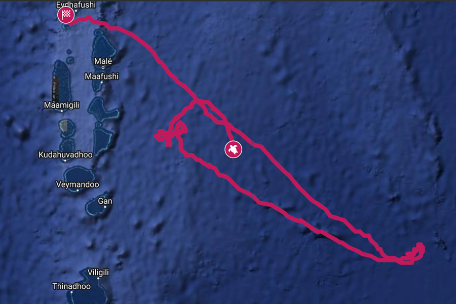
ORP’s satellite tagging project aims to explore the movement ecology of olive ridley turtles to determine which points along their tracks suggest possible foraging behaviour and possible fishery interaction. These points can then be correlated with characteristics that are important for sea turtle development, such as sea surface temperature, and primary productivity, i.e. roughly the rate of photosynthesis in a specific region.
With the collected information we will be able to identify what environmental characteristics make habitats in the Indian Ocean suitable for olive ridley sea turtles. This field of research is also known as spatial ecology.
Population Genetics
We are excited to embark on a new project in collaboration with the Centre D’Etude et de Decouverte des Tortues Marines (CEDTM) and Kelonia, L’observatoire des Tortues Marines de La Réunion (KELONIA-RMR). By looking at different parts of the genome, we can make assumptions on how closely different sea turtle populations are related and how high the internal genetic variation is within these populations. E.g., if turtles from different countries are closely related on a genetic level, there might be interbreeding between turtles from both populations. For conservation measures to have a protective effect, both populations from each country need to be looked at together in such a case. The genetic variability within a population has implications for its resilience towards disturbances such as climate change and diseases.
It is hoped that the results will improve our knowledge on the spatial distribution and connectivity of hawksbill sea turtles in the Western Indian Ocean. ORP will provide tissue samples of injured and sick resident hawksbill sea turtles in the Maldives for genetic analyses. We are excited to continue to collect samples in preparation for analyses at the end of 2021.
Additionally, ORP together with the Environmental Protection Agency of the Maldives (EPA) is planning a research trip collecting additional tissue samples from wild and healthy hawksbill turtles in the central atolls in 2022. This is the first broader scale systematic genetic analysis of sea turtles in the country and will help us understand the genetic variability of hawksbill turtles in the country, as well as the connectivity of hawksbill populations in each separate atoll.